Best Locations & Current Conditions for Wildflowers in Southern California
Bakersfield, Chino Hills, Lake Elsinore, Lancaster, Rancho Palos Verdes, Santa Margarita, and Thousand Oaks, California
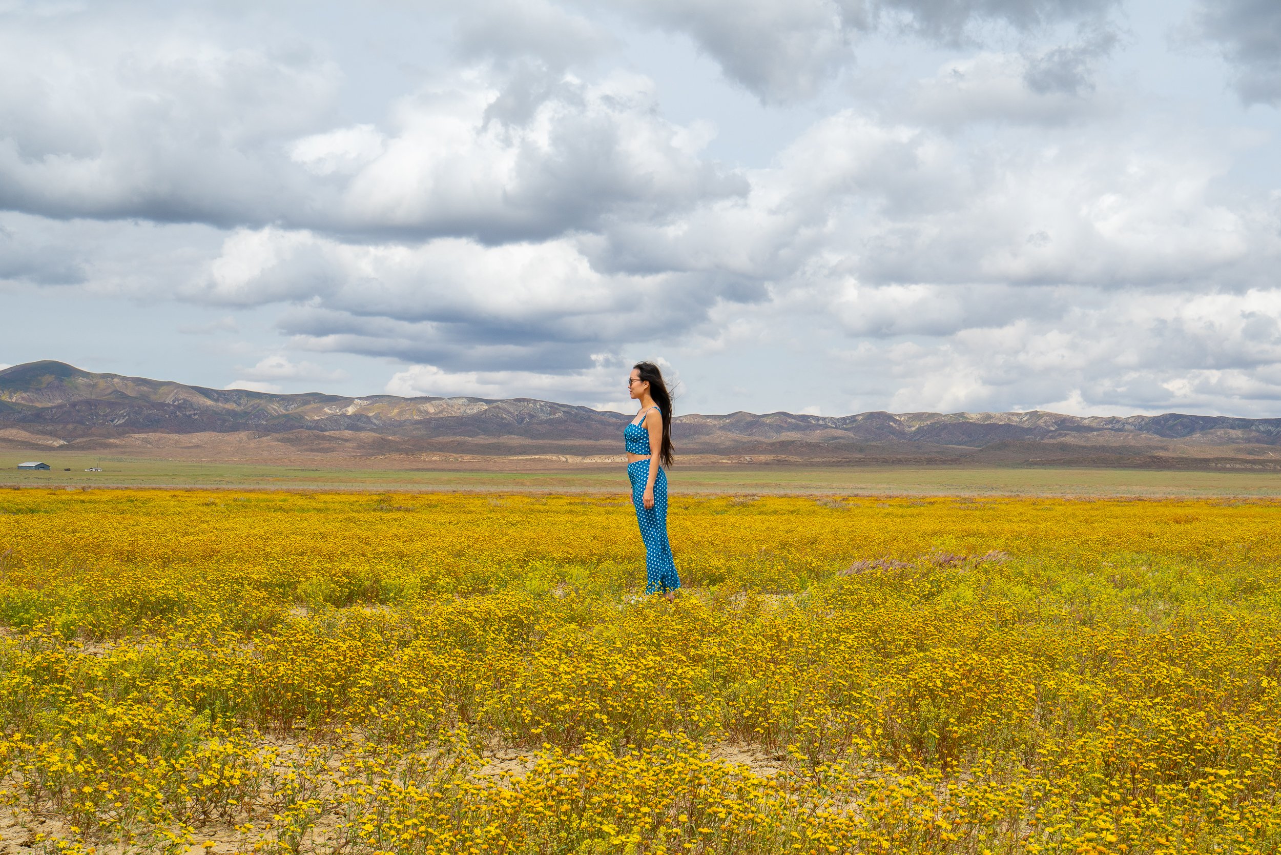
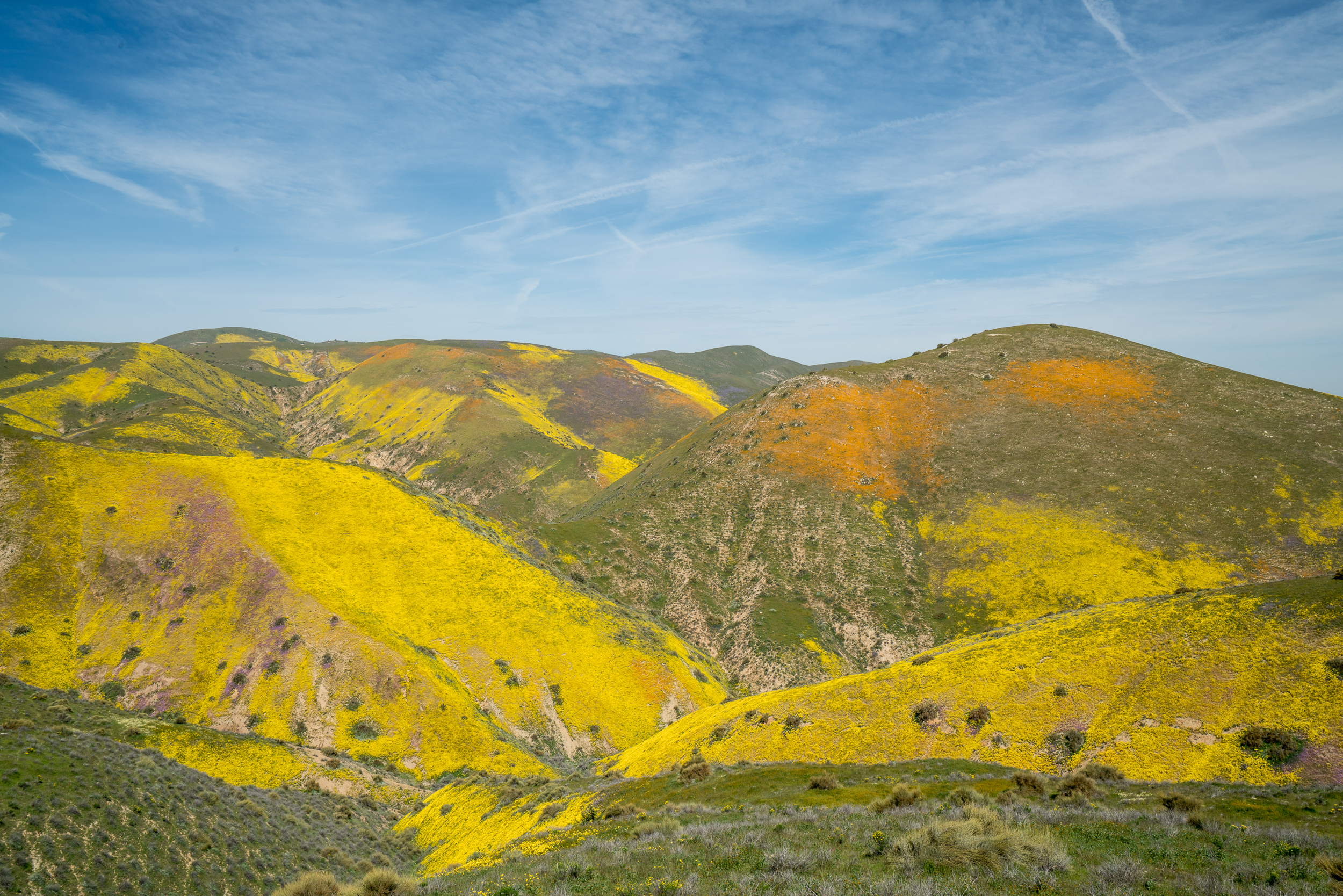
Carrizo Plain National Monument, California 2023
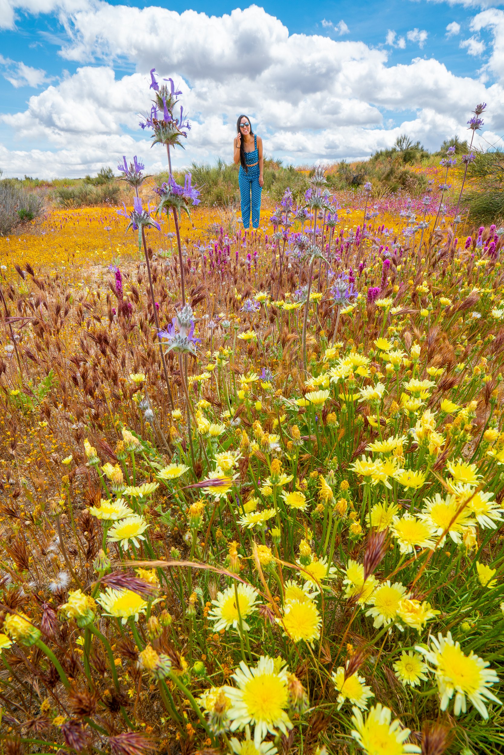
Carrizo Plain National Monument, California 2023

Carrizo Plain National Monument, California 2023

Antelope Valley Poppy Reserve, California 2022

Chino Hills State Park, California 2023

Antelope Valley Poppy Reserve, California 2020
Heavy winter rains can bring a SUPER BLOOM of wildflowers all over Southern California, and of course, very little rain means very FEW wildflowers. The best months for wildflowers are February through July, with March and April being the peak months. When searching for wildflowers, watch out for rattle snakes, bring plenty of water, and please stay on the trails. If you don’t stay on the trails, the wildflowers may never come back anywhere you took a step - for locations that are very popular, this could mean that location may never be the same again. This guide provides a list of the best locations to find wildflowers in Southern California as well as the most informed resources where you can check the current wildflower conditions. The photos below are from years when there were good rains (each photo shows the year in which the photo was taken), so we recommend checking the resources we’ve listed at the bottom of the page for current wildflower conditions and seeing if any of the best locations we’ve listed below are showing good signs of a bloom - if they are, then we think it’s definitely worth a visit.
P.S. No wildflowers were harmed when taking the photographs on this page - while the photos may LOOK like we’re standing or driving on wildflowers, we are not. The photos were either taken from a low angle so as to hide the trail or there was a trail already there that cannot be seen from the readers point of view.
Best Locations for Wildflowers
Carrizo Plain National Monument (Santa Margarita): This one should be at the very top of your list! Rolling hills w/the largest variety of wildflowers you'll find and huge patches of purple, yellow, and orange colored wildflowers - this place is nothing short of amazing and who knows when it'll look like this again. You can find a map of the area HERE. I would recommend starting at the south entrance from Hwy 166 and making your way up through the National Monument driving along Soda Lake Road. You'll see huge flower patches as you drive and some dirt roads you can follow to get closer to them, so plan on making many stops. When you finally reach Soda Lake (also cool to see), take a right onto Simmler Road. Hang another right when you reach Elkhorn Road and continue until you reach Hurricane Road. Take a left onto Hurricane Road and prepare to stop many times to take photos. This road will eventually turn into Crocker Springs Road. When you reach the end of the road, use your GPS for directions to the small town of Taft to get some gas and grab a bite to eat before heading home. One big tip here - bring a vehicle that has good ground clearance, good tires, is in good condition, and is fully fueled. Just about all of the roads in this remote area are dirt roads and some can be pretty rough at times. If you have a low clearance vehicle, I’d skip taking Hurricane and Crocker Springs Road. Also, keep in mind that there are no gas stations within this entire area and cell phone reception is spotty at best. Approximate hiking distance (roundtrip): barely any at all.

Carrizo Plain National Monument, California 2019

Carrizo Plain National Momument, California 2019
Carrizo Plain National Monument, California 2019

Carrizo Plain National Monument, California 2019

Carrizo Plain National Monument, California 2019

Carrizo Plain National Monument, California 2017

Carrizo Plain National Monument, California 2019
Chino Hills State Park (Chino Hills): Park for free on Sapphire Road just outside the northern most entrance to the park. There are very few signs for any of the trails here, so pay careful attention to the directions. Walk up the road that enters the park until you reach a yellow gate on your right. The gate is located next to the speed limit and closed area signs (don’t worry, it’s only closed to motor vehicles) and you’ll reach it before the big white water tank and the parking booth. Continue on the dirt path that is beyond the yellow gate, this will lead you to a fork in the trail where you can either take the Sidewinder Trail or the Bain Ridge Trail. When you reach the first fork, head to your right, onto the Sidewinder Trail. Out in the distance to your right you’ll see your final destination, the flower fields pictured below. The Sidewinder Trail will lead you down the hill. The first intersecting trail you’ll come across is the Upper Aliso Canyon Trail. The Upper Aliso Canyon Trail is easy to miss, so keep a good eye out - it will be near the very bottom of the hill that the Sidewinder Trail brought you down. The Upper Aliso Canyon Trail will lead you up a different hill. Hike along the Upper Aliso Canyon Trail for a bit until the trail starts to head back down that same hill that you’ve been going up. Keep an eye out for an intersecting trail to your right which leads to the very top of the hill - this trail is the one you’ll want to take. The trail has no name and a small part of the trail is bushy (best to have pants for this part). Continue on all the way up to the ridge and you’ll see various hillsides full of flowers as you hike along the ridge. You can find a map of the park HERE (the Park Brochure under the Brochures section). Approximate hiking distance (roundtrip): 6 miles.

Chino Hills State Park, California 2019

Chino Hills State Park, California 2019

Chino Hills State Park, California 2019

Chino Hills State Park, California 2019

Chino Hills State Park, California 2019

Chino Hills State Park, California 2017

Chino Hills State Park, California 2019

Chino Hills State Park, California 2019
Walker Canyon (Lake Elsinore): Unlike Chino Hills, this is one is simple - your GPS will take you directly to the wildflower area along Walker Canyon Road. There are two access points to explore this area. The more popular side is the trailhead that starts at the corner of Lake Street and Walker Canyon Road. The second trailhead is at the other end of Walker Canyon Road, where the road dead-ends. You can hike either side or you can even do a loop that connects the two ends. The roundtrip distance for the loop is approximately four to five miles. Heads up, this will be a VERY BUSY area during the bloom season. Just remember though, the further you hike out, the less people there will be (and better photos you’ll take too). Expect that it will be difficult to find parking and that you’ll more than likely have to park far away from either trailhead. As of 2023, the City of Lake Elsinore has unfortunately closed the area to visitors due to the City government's poor planning and its limited knowledge to manage large crowds. It decided that it would rather take the opportunity away from everyone (both locals and outsiders) to experience what is an increasingly rare phenomenon (historically, super blooms only happen every 5 to 10 years, but will happen even less as time goes on as a result of climate change) than to spend their money to plan and consult with various agencies/experts that manage large crowds.

Walker Canyon, California 2019

Walker Canyon, California 2019

Walker Canyon, California 2019

Walker Canyon, California 2019
Abalone Cove Shoreline Park (Rancho Palos Verdes): For the best views of the wildflowers in this park, hike the Olmstead, Smuggler, and Sacred Cove View Trails. Click HERE for a map of the park and don’t forget to check out the sea caves too! For a more detailed guide on the park and directions to the caves, click HERE.
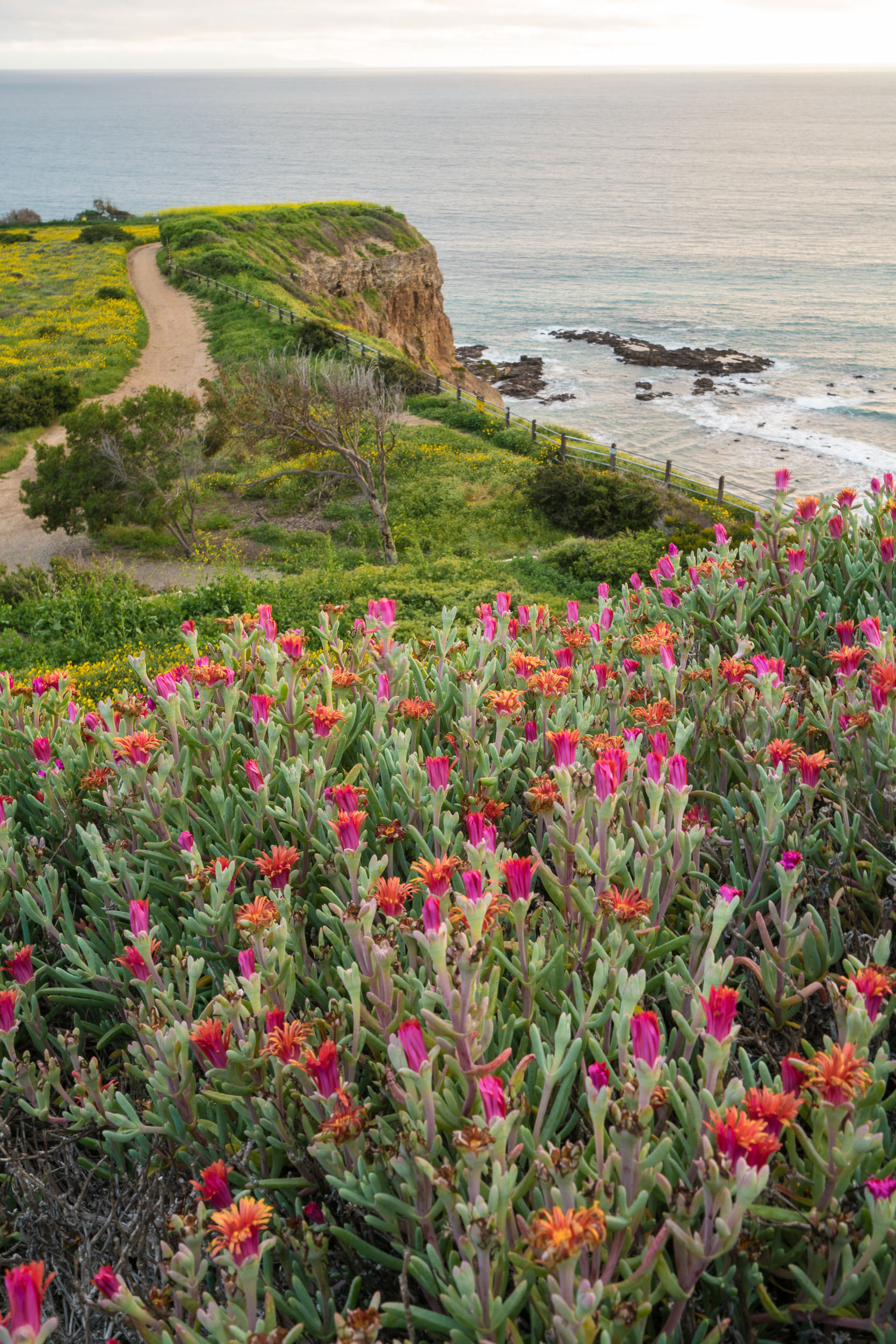
Abalone Cove Shoreline Park, California 2017
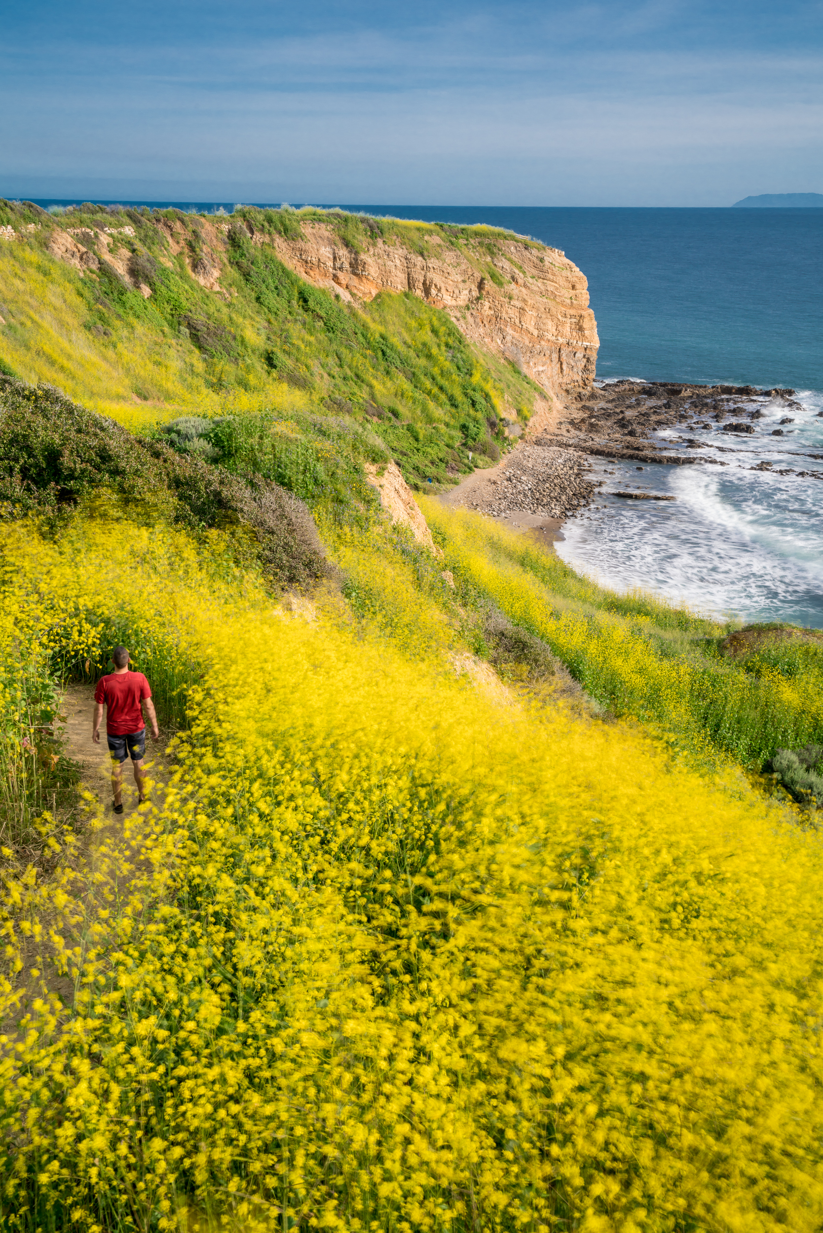
Abalone Cove Shoreline Park, California 2019

Abalone Cove Shoreline Park, California 2017

Abalone Cove Shoreline Park, California 2017

Abalone Cove Shoreline Park, California 2019
Antelope Valley Poppy Reserve (Lancaster): Another easy one to get to - GPS it there, park and you'll see exactly where to go. The flowers here are in plain sight as well. Approximate hiking distance (roundtrip): 2 miles. If you have an off-road vehicle, you’ll also find some fun dirt roads just outside the reserve to explore.
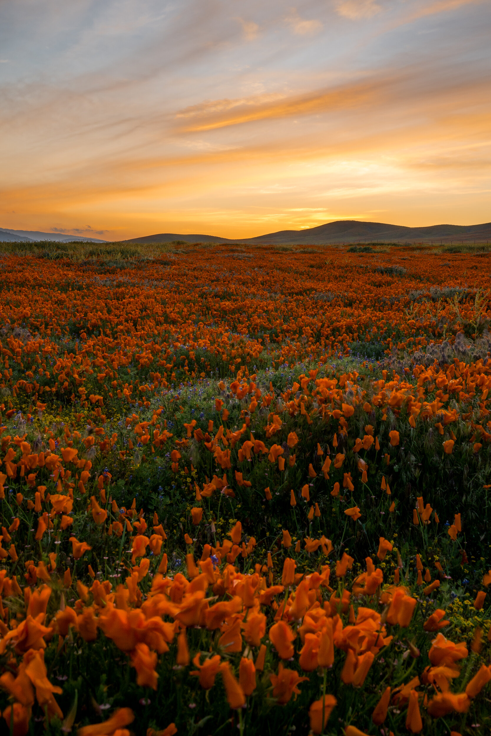
Antelope Valley Poppy Reserve, California 2020

Antelope Valley Poppy Reserve, California 2022

Antelope Valley Poppy Reserve, California 2022

Antelope Valley Poppy Reserve, California 2022

Antelope Valley Poppy Reserve, California 2022
Wildwood Regional Park (Thousand Oaks): Park at the main entrance and walk along the Mesa Trail which starts at the posted trail map. About 10 minutes down this trail, take a right onto the Santa Rosa Trail and head up the hill. You'll be walking through the wildflowers seen below until finally you the reach the ridge. Click HERE for a map of the park (click on the Trail map). Approximate hiking distance (roundtrip): 1.5 miles.

Wildwood Regional Park, California 2017

Wildwood Regional Park, California 2017
Wind Wolves Preserve (Bakersfield): On your drive in, you'll get great views of the rolling hills in the distance and the first view below. To see the spot in the other photos, you'll have to park at the main dirt lot and head out onto the San Emigdio Canyon Trail until it reaches the end and intersects with the Reflection Pond Trail. You'll see the flowers on your left when you reach the Reflection Pond Trail and you can head straight up the trail to get a better look. There's not much shade - so make sure to bring sunblock, a hat, plenty of water and some snacks. The San Emigdio Canyon Trail is pretty much flat the entire way and it's only the Reflection Pond Trail that has a bit of an elevation gain. You can find a map of the preserve HERE (see the Trail Map under the resources section). Approximate hiking distance (roundtrip): 6 miles.

Wind Wolves Preserve, California 2017

Wind Wolves Preserve, California 2017

Wind Wolves Preserve, California 2017
Current Wildflower Conditions
Theodore Payne Foundation: This non-profit organization provides weekly online and recorded updates on various wildflower locations from March through May. Click HERE to see the updates and to find out more about this organization.
Antelope Valley California Poppy Reserve: To see the current conditions of the poppy reserve and learn more about this state park, click HERE.