Most Beautiful Day Hikes in Grand Staircase-Escalante National Monument
Escalante, Utah

Cosmic Ashtray, Utah

Lower Calf Creek Falls, Utah
Golden Cathedral Trail, Utah
Having the largest land area of all U.S. National Monuments, Grand Staircase-Escalante will give you plenty to explore. It's also one of the more remote and undeveloped outdoor areas to see. If you're looking for picnic tables, restrooms and water fountains, this is not the location for you. But, if you're looking to get off the grid - this is all you! This guide provides some general travel tips for visiting Grand Staircase-Escalante as well as a list of the most beautiful day hikes there.
General Travel Tips
Drive a high clearance 4x4 vehicle or rent one - the roads here can be really rough and this isn't the type of place to get stuck. It's remote and there's no cell signal.
Bring a GPS unit. If you're lucky you'll see a trailhead sign, but in most cases you won't. Once you get on the trail, there is no signage and you might come across some cairns (stack of stones that hikers leave to let the next person know where the trail is), but you might not. I've used and recommend the Garmin Oregon 750t. I've included files for your GPS on this page that you can download. You must put them into the GPX folder of your GPS.
One of the best general, overall maps you can use to find trailheads will be from the Escalante Interagency Visitor Center: 755 W. Main St., Escalante, UT 84726 (435) 826-5499, open 8:00 AM - 4:30 PM. They're also a great resource to check in with regarding road and trail conditions. Another good map to have is through an app called Maplets. It'll cost you a few bucks, but you can download and even request GPS enabled maps including one for this monument. These maps will work without a cell signal using the GPS in your phone.
Bring extra supplies for everything - at least a spare tire, water and food. Again, it's not the type of place to get stuck.
If you plan to camp overnight, make sure you stop at one of the visitor centers to pick up an overnight permit. They're free and they give out as many as they can. You're not allowed to camp at any trailhead, but you can camp off of any road that connects to Hole-in-the-Rock-Road. You'll have to drive down the different dirt roads and look for campsites showing signs of prior use. There are no facilities (water, toilets, showers) along the road, so be prepared to rough it.
Staying in town instead of camping or just tired of camping food? Be sure to try the pizza at Escalante Outfitters Café (west of Escalante on Route 12) and make a stop for some coffee and baked goods at Kiva Koffeehouse.
When heading out on your hike, bring a minimum of 3 Liters of water just to be safe in case you get lost.
Research the weather - if you're hiking in a slot canyon and it rains, your life will be at risk. In addition, most of the roads here are dirt roads which could become impassable if it rains.
In April of 2017 President Trump signed an executive order directing the Department of the Interior to research the feasibility of disbanding national monuments that are over 100,000 acres, including Grand Staircase - Escalante. This could open up the entire area to mining and who knows what else that could potentially destroy or pollute the environment there. I'd recommend visiting sooner than later. If you see a petition to help protect this amazing place - sign it.
Most Beautiful Day Hikes
Jacob Hamblin Arch (part of Coyote Gulch): There are multiple ways to get here - Red Well, Hurricane Wash, Fortymile Ridge and a few others. I would highly recommend making this one a backpacking trip. There are some amazing camp sites down there, a good water source, and views & exploring for days. I chose to get there as a day hike from Hurricane Wash. The round trip hiking distance to the arch from Hurricane Wash is about 12.5 miles. If you still have the energy once you get there, hike a few more miles to see the Coyote Natural Bridge. The trailhead for Hurricane Wash is 33 miles down Hole-in-the-Rock-Road from Route 12. You can download my GPS track for this hike HERE.

Jacob Hamblin Arch, Utah

Coyote Gulch, Utah

Coyote Natural Bridge, Utah
Dry Fork Slot Canyons (Dry Fork, Peekaboo, and Spooky): Three slot canyons should be enough to motivate you to explore this spot. BUT, there are a few things to be aware of, so read carefully. Dry Fork slot canyon is easy - just about anybody can hike it. It will be the first slot canyon you reach on your left when hiking down into the canyon. Peekaboo slot canyon involves going up a 15 foot rock face that has a few footholds you can use, but don't plan on bringing a huge backpack. Once you reach the end of Peekaboo, follow the GPS track to Spooky slot canyon. Spooky in general can be a bit tricky. One - this is not a hike for bigger folks, you need to be somewhat skinny or you literally will not fit in certain parts of this slot canyon. The other two obstacles to this hike - two 7 foot drops. One is a boulder jam and one is a straight drop with very few if any footholds. You'll want to be tall or have some rock climbing skills. The round trip hiking distance for all three slots is about 8 miles. The trailhead for Dry Fork Slots is about 30 miles down Hole-in-the-Rock-Road from Route 12. You can download my GPS track for this hike HERE.

Dry Fork Slot, Utah

Dry Fork Slot, Utah
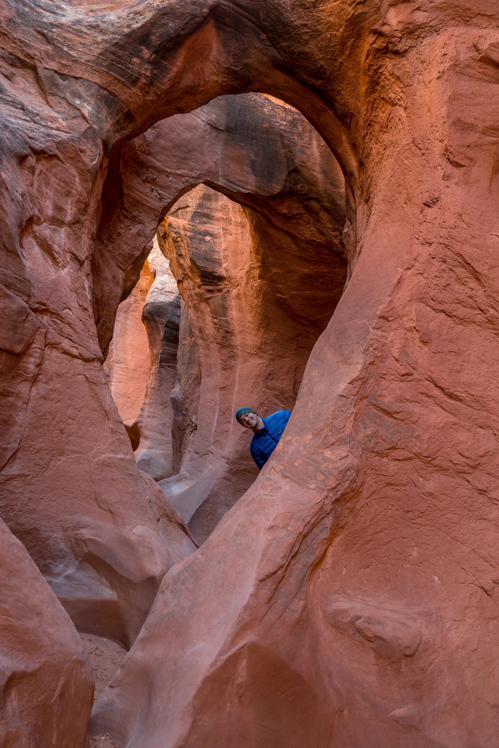
Peekaboo Slot, Utah

Spooky Slot, Utah

Spooky Slot, Utah

Spooky Slot, Utah
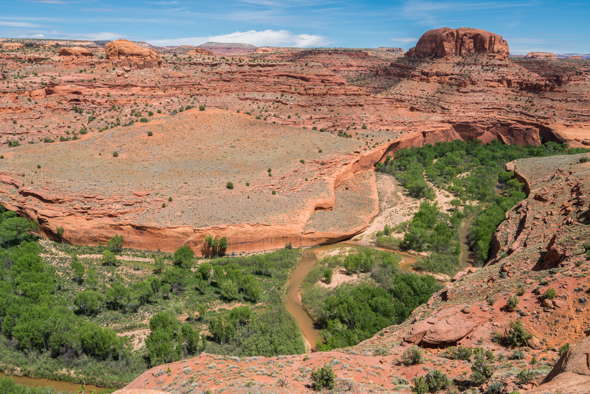
Golden Cathedral: This 11 mile hike will bring you to some amazing places! You'll get cliff top views of the Escalante River, you get to cross the river itself and last but not least, you'll reach the cool overhanging rock formation below. There are two routes and the one I chose is much less travelled and there are few if any cairns. GPS will be a necessity if you take the route I did. The trailhead for Golden Cathedral is 9 miles down Egypt Road. Egypt Road is 16.5 miles down Hole-in-the-Rock-Road off of Route 12. On Egypt Road, make sure to keep right and follow the sign that says "Trailhead 1 Mile." You can download my GPS track for this hike HERE.

Golden Cathedral, Utah
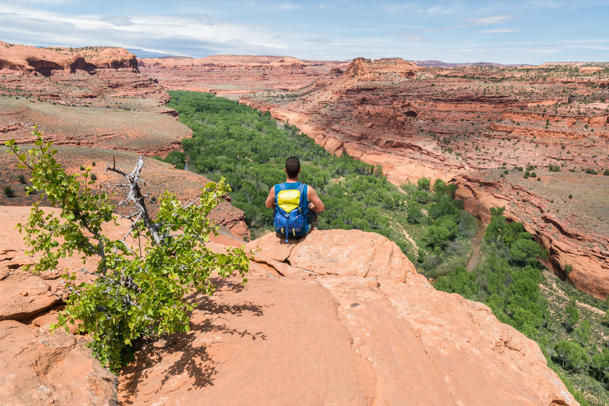
Golden Cathedral Hike, Utah
Zebra & Tunnel Slot Canyons: These are another two slots worth checking out. The fun part of these two is that you may need to dip into the ice cold water to get to the good parts. When I went, water in both slot canyons was up to my knees in some parts (I'm 6'1") and the water was so cold that if I stayed in it too long, my feet became numb. Zebra is the more beautiful of the two canyons but it also has a few spots that are so small that both of your feet will not even fit on the ground (even the one foot on the ground will be tilted to the side). Tunnel slot canyon is pretty small and somewhat unimpressive, but if you hike Zebra, you might as well go to Tunnel as well. The round trip hiking distance for both slots is about 8 miles. The trailhead for Zebra and Tunnel slot canyons is 8 miles down Hole-in-the-Rock-Road from Route 12. You'll see a dirt parking lot on your right and the unsigned trailhead will be across the dirt road on the left. You can download my GPS track for this hike HERE.
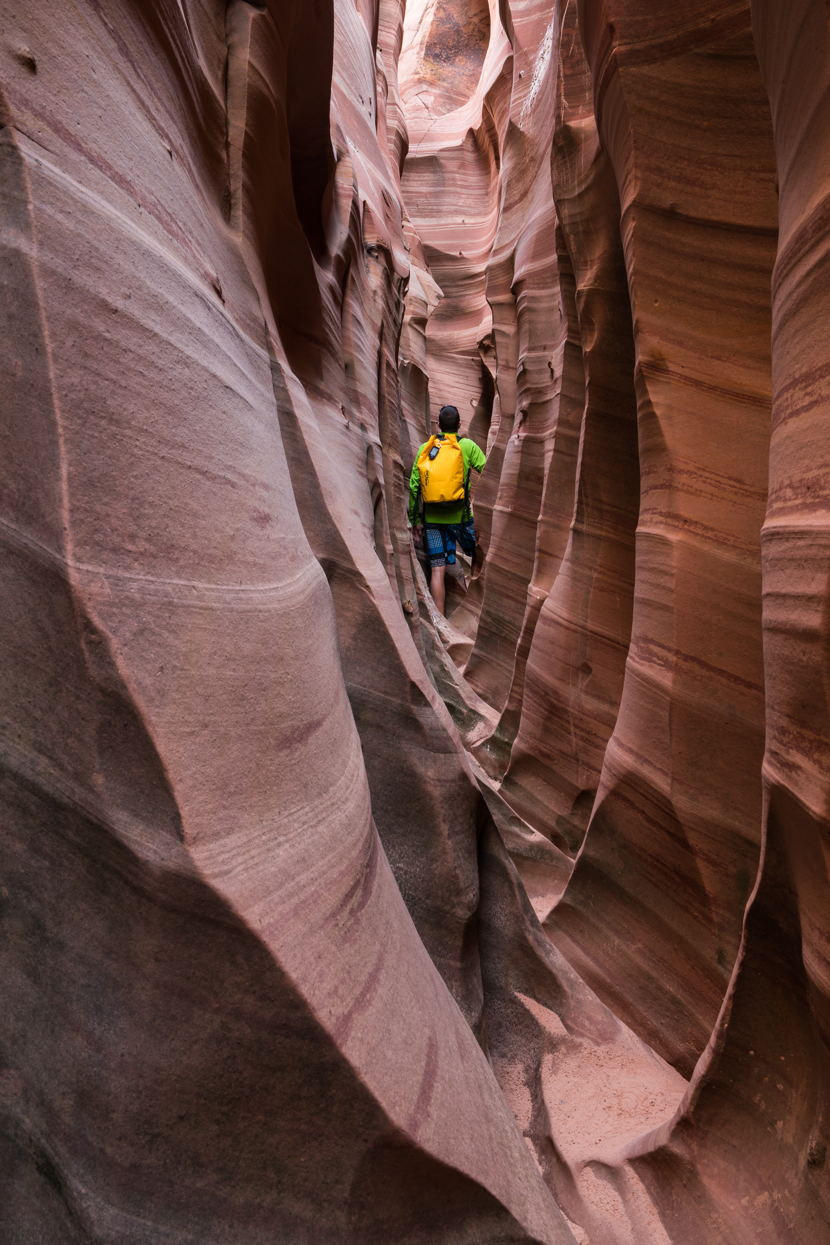
Zebra Slot, Utah

Tunnel Slot, Utah
Cosmic Ashtray: This place is an amazing, unique geological formation that you won't find on any hiking maps. If you look it up on google maps it will show up, but to figure out how to get there is another story. I compared Google's road maps, topo maps and satellite images to the topo map on my GPS and made a route which brought me straight to this amazing place. The round trip hiking distance is about 8 miles. The trailhead for the Cosmic Ashtray is at the end of Spencer Flat Road. Near the end of the road, you'll see that you can either continue straight or head right - make sure to stay straight. Spencer Flat Road is off of Route 12, west of the town of Escalante. You can download my GPS track for this hike HERE.
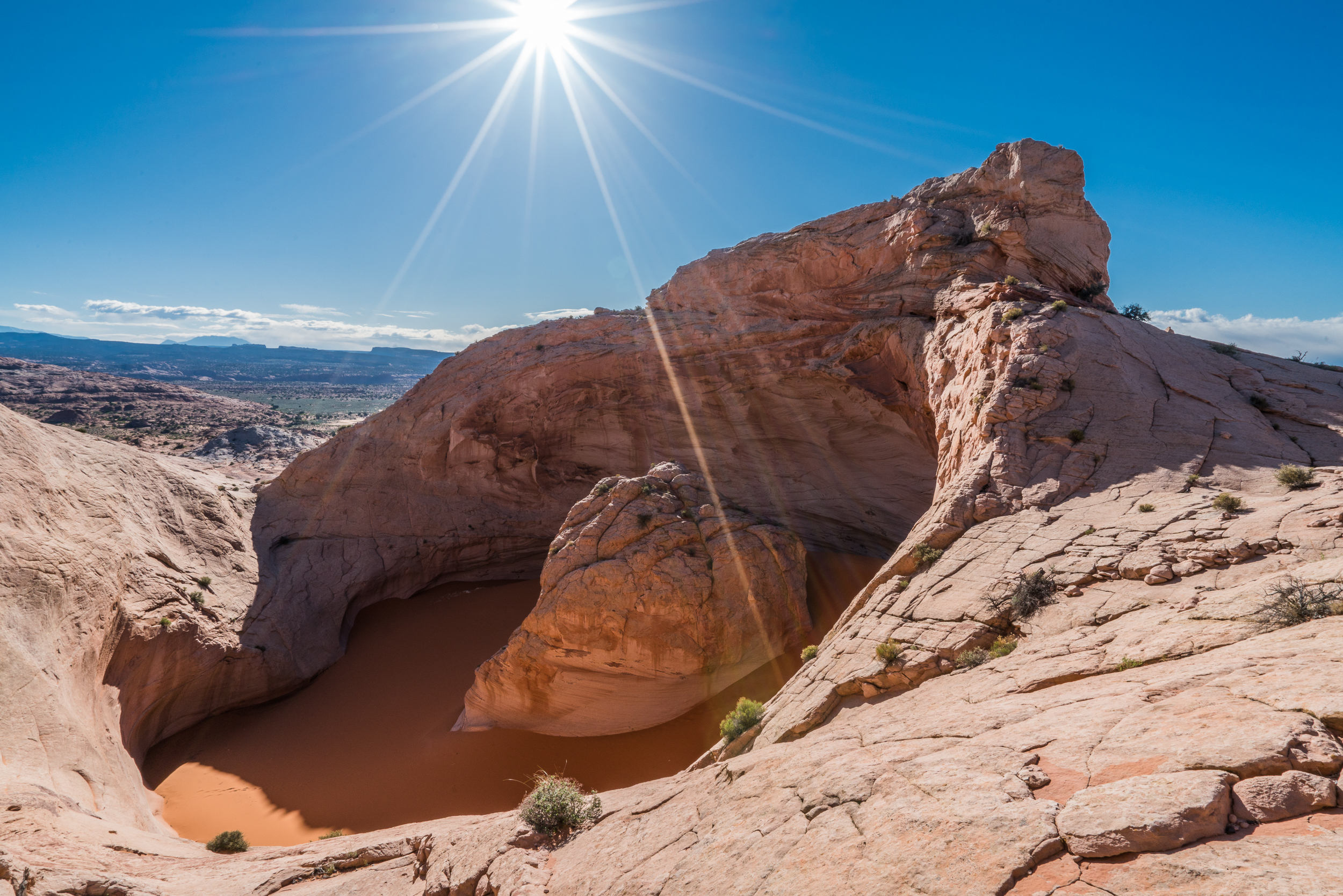
Cosmic Ashtray, Utah

Cosmic Ashtray, Utah
Lower Calf Creek Falls: While this isn't the trail for hikers looking for solitude, it does have a 130 foot high waterfall. The photos don't really do this place justice and even I wasn't too impressed until I saw it for myself - it was totally worth it. The round trip hiking distance is about 6 miles. The trailhead is located at the Calf Creek Campground on Route 12, 15 miles west of the town of Escalante. There is day parking fee of $5 and car camping sites are available. You won't need your GPS for this trail as it is one of the few that is very well marked.

Lower Calf Creek Falls, Utah

Lower Calf Creek Falls, Utah